
Magnetotellurics (MT and AMT) Geophysical Survey Methods
Overview
Magnetotellurics (MT) and Audio-frequency MT (AMT) are electro-magnetic survey and imaging techniques that use naturally-occurring ionospheric current sheets and lightning storms — passive energy sources — to map geologic structures to depths of 500 meters or more.
The MT geophysical survey method combines measurements of the earth’s electric field and magnetic field over a wide band of frequencies. Low frequencies sample deep into the earth and high frequencies correspond to shallow samples.
Principles
Natural-source signals are generated in the atmosphere and magnetosphere. MT signals (low frequencies < 1 Hz) are generated by the interaction between the earth’s magnetosphere and the solar wind, sunspot activity, and auroras. High-frequency sources (> 1 Hz) in the audio range (AMT) are generated by thunderstorms and lightning worldwide. more
These time-varying electric and magnetic fields induce currents into the earth and oceans. The currents produce magnetotelluric signals that are measured over a range of frequencies using grounded dipoles and magnetic field antennas. Ground resistivity values are then calculated from the MT measurements.
Applications
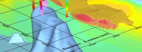
MT surveys are typically employed for investigating deep structures. Geothermal systems, for example, typically exhibit electrical resistivity contrasts at depths of several kilometers, a depth accessible to MT but not to other electromagnetic methods. The ability to identify geologic features using this method varies with depth, target size, the resulting resistivity contrasts, and their geometry.
Equipment
Zonge’s GDP receiver-based equipment for MT and AMT surveys can be configured to investigate very different targets by selecting the appropriate array configuration and frequency bandwidth. The AMT array can also be configured to collect CSEM / CSAMT-type scalar, vector or tensor field data. All data are then processed with the Zonge DATPRO software and the results are imaged using the Zonge SCS2D inversion software.
High-resolution MT data acquisition
Zonge’s new wireless, ZEN High-res Receiver™ uses a 32-bit analog-digital converter (ADC) designed specifically for geophysical applications to collect the highest-resolution data possible, even in relatively “noisy” environments.
ZEN™ can be used in networked arrays with or without the GDP. Its small size and light weight makes ground acquisition of MT data feasible and affordable even in difficult terrain.