
Levee integrity study covers four miles in five hours
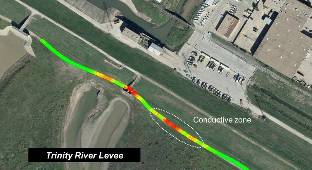
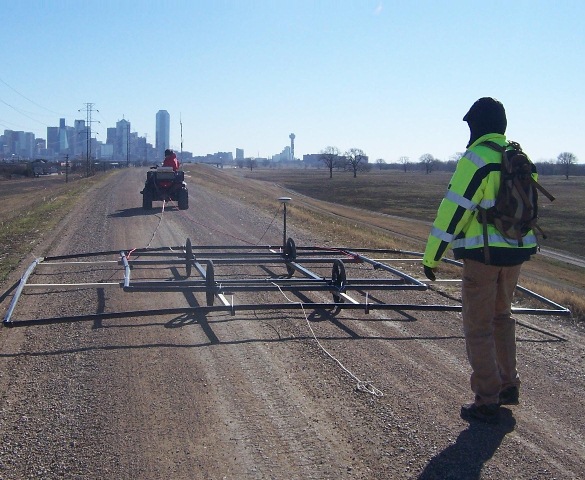 More than four miles of the Trinity River Levee near Dallas, Texas were surveyed using MASW and DNT™ techniques in a single day due to the use of mobile and rapid-deployment equipment.
The multi-channel analysis of surface waves (MASW) seismic method was chosen to determine any at-risk soft spots. MASW data was acquired using a land streamer of geophones that could be quickly laid out behind a vehicle, reducing set-up time.
The Zonge Dynamic NanoTEM™ (DNT) mobile transceiver and a towed five-meter loop were used to collect resistivity data. Results clearly revealed a conductive anomaly indicating seepage.
Detecting structural components and
seepage zones for geotechnical review at Eagle Mountain Dam and Spillway
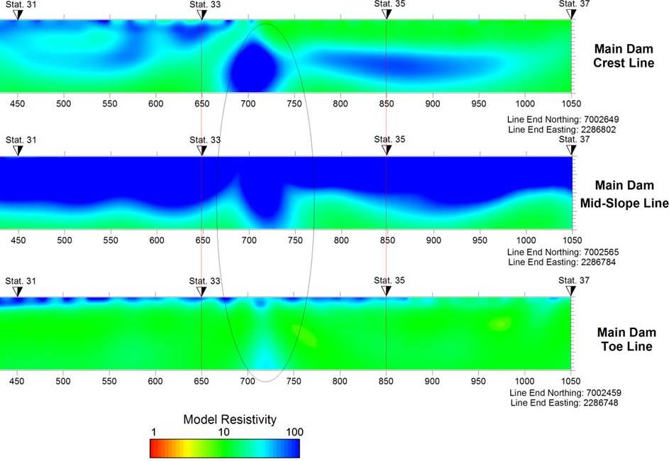
Zonge contributed interpreted geophysical data to a comprehensive geotechnical review of Eagle Mountain Dam and Spillway Levee, two separate, earthen structures north of Lake Worth, Texas maintained by the Tarrant Regional Water District. A combination of methods was used for determining depth below the dam crest and the position and limits of known sheet-piling to guide remediation drilling activities.
Canyon Lake Dam project necessitates innovative
geophysics survey and modeling solution
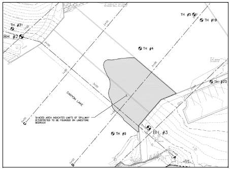 The Zonge project manager for this challenging job created a solution for overcoming logistical constraints and background noise from fast-moving water to use MASW as a shallow-marine technique on a concrete spillway near Rapid City, South Dakota.
The survey goal was to provide information between dam pre-construction boreholes, and generate a 2D cross-section profile showing depth to bedrock beneath the structure. Ultimately this data would be used to determine remedial solutions to mitigate ever-worsening seepage and to extend the life of the structure.
more about MASW
In the Trinity Levee survey, multiple soundings were collected along a line using equally-spaced geophones to map the lateral as well as vertical profile. For the Canyon Lake Dam survey, by using several different source-receiver array configurations and integrating the data during processing, a better, deeper 2D profile than what a standard single array configuration would have produced could be created for this site. And the inclusion of more data points increased redundancy and confidence in the modeled results.