
Topography with Smooth-Model Resistivity and IP Inversion (TS2DIP)
- Input Zonge, Geosoft or spreadsheet data.
- Use time-domain or frequency-domain data with lines up to 200 dipoles long and n-spacings between 0.25 and 100.
- Interactively edit the background model to include known geology.
- Weight constraints for geologic conditions.
- Enter topographic profile information to include terrain.
- Generate GeoSoft and Surfer plot files.
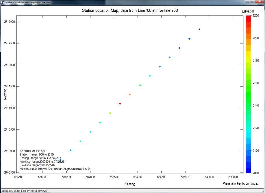
Graphically display station locations and elevations.
Automatically generate Surfer and Geosoft model plots.
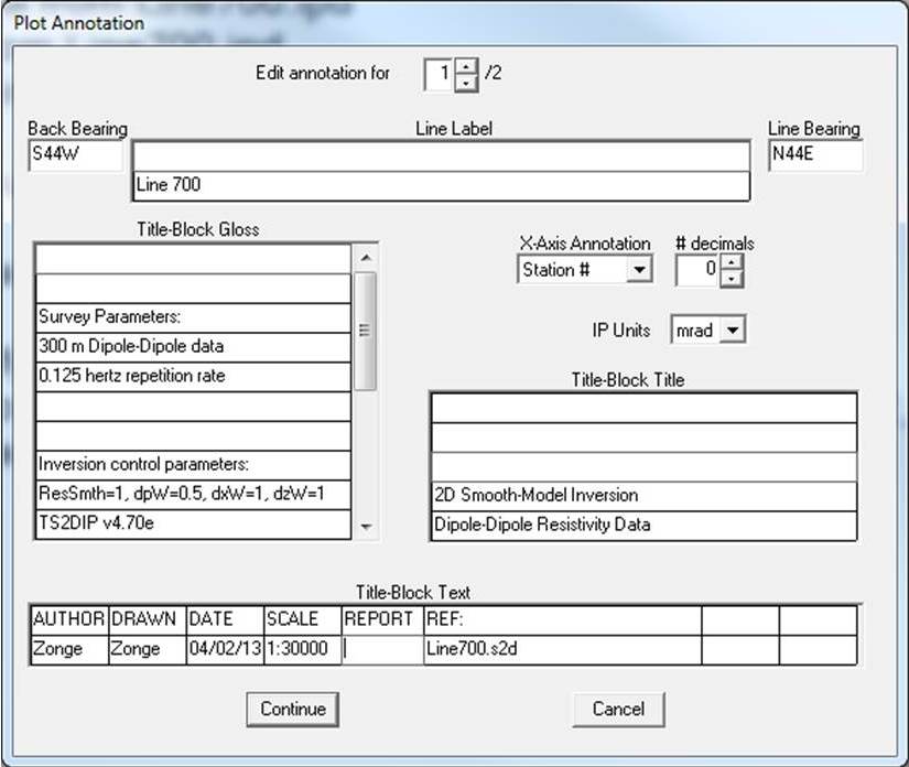
Edit final plot annotation.
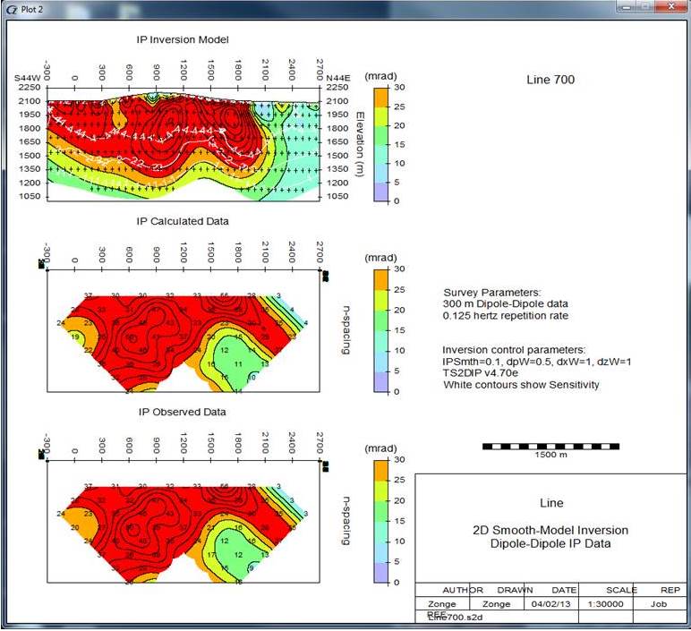
Automatically generate Geosoft or Surfer plots: IP model, calculated data, observed data, and difference plots.
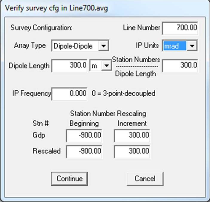
Enter and edit survey metadata.
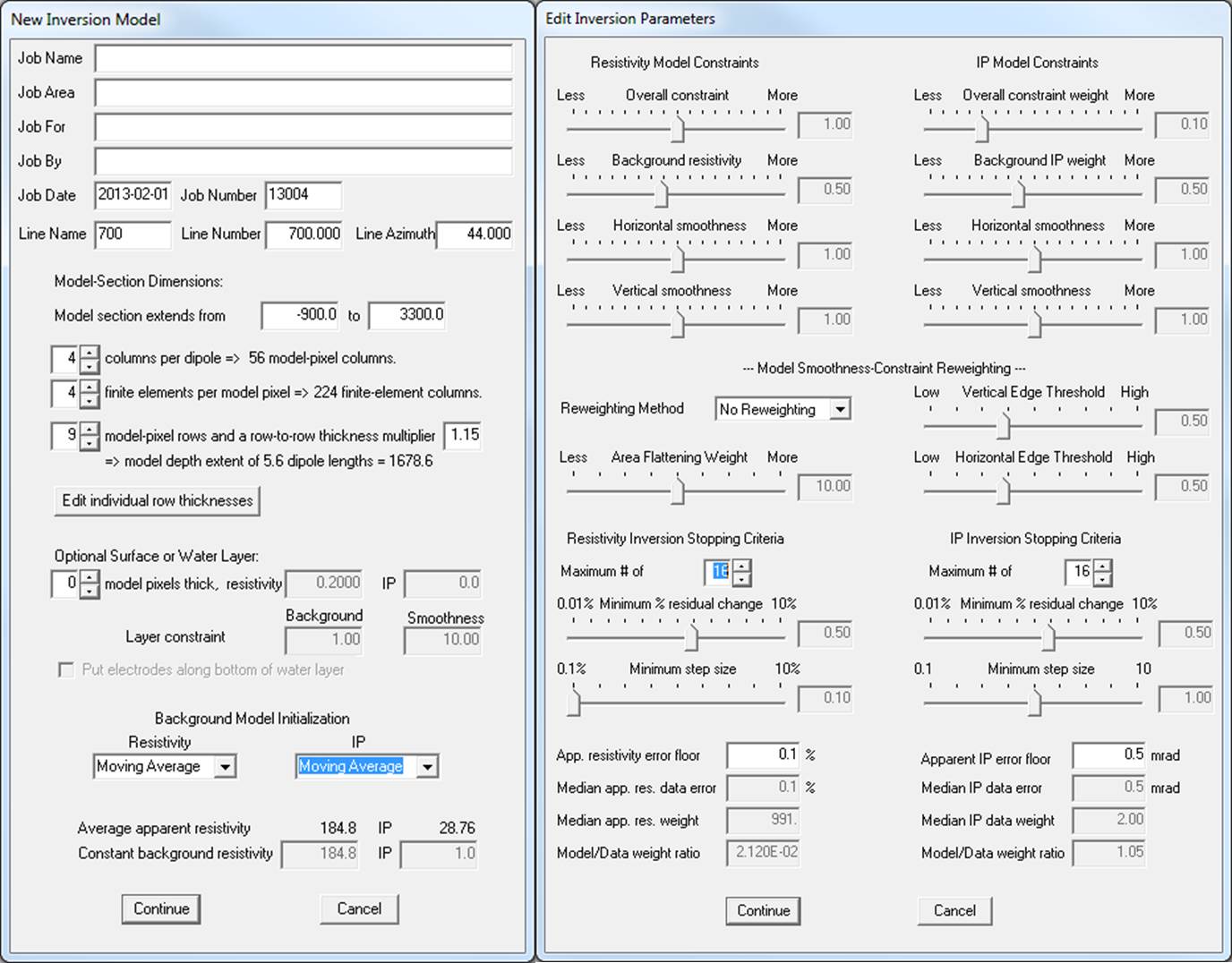
Interactively adjust any or all inversion controls and the regularization mesh.
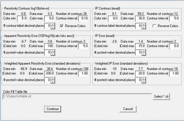
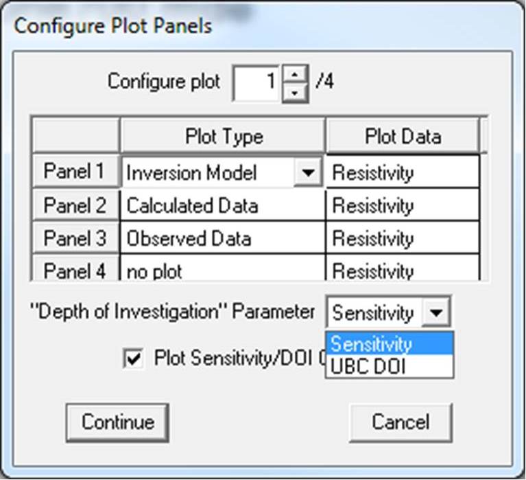
Control and configure plot contouring.
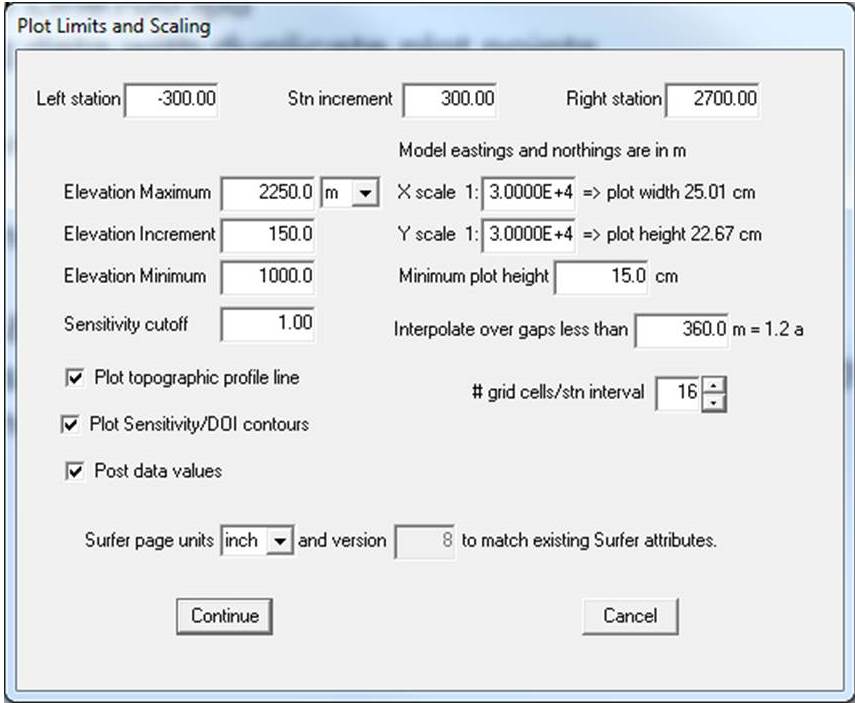
Define plot limits and scaling.

Automatically generate Geosoft or Surfer plots: resistivity model, calculated data, observed data, and difference plots.
back